
Table of Contents
Every living organism adapts to its immediate environment. When a maple tree grows in a dense northern forest, its leaves expand and angle toward the available sunlight. When a cactus survives in a dry desert, its entire structure changes to store water and endure heat. Human beings operate under the very same biological rules. We never experience our lives in a vacuum. Everything we think, feel, and decide is shaped by where our feet are planted on the physical earth.
When people interact with the digital world through screens, they do not leave their physical reality behind. A reader browsing a website while riding a subway train in a rainy city has an entirely different set of needs, stresses, and mental priorities than someone sitting at a wooden desk in a sunny rural town. For years, the internet treated every visitor as if they lived in the exact same placeless void. Websites delivered identical text, identical images, and identical layouts to everyone regardless of their actual setting.
That outdated, one-size-fits-all model fails because it ignores human biology and basic context. Today, understanding how physical place shapes digital focus is essential. By studying how a user location affects human behavior, web designers and engineers can build web systems that feel natural, effortless, and instantly helpful.
The Physics of Attention
Human attention is a finite biological resource. In nature, living creatures must constantly filter out background noise to focus on what matters for their survival and comfort. If a signal in the environment does not match your immediate surroundings, your brain quickly ignores it to save energy. Digital content works the exact same way. When a person opens a webpage, their brain decides within fractions of a second whether the material is worth their limited focus.
Attention drops the moment there is a mismatch between what a person sees on a screen and where they are physically standing. If a website displays promotions for winter snow gear to a visitor sitting in ninety-degree summer heat, the brain recognizes an immediate error. This mismatch forces the reader to spend extra mental effort sorting through useless data. When content matches the physical realities of the user location, cognitive friction disappears. The digital interface feels like a natural extension of the room or landscape around the visitor.
Connecting digital content to a user location creates immediate relevance. When the text, visuals, and offers match local conditions, the visitor does not have to mentally translate the message to fit their life. The screen reflects their world directly, which allows their attention to settle comfortably on the main message instead of searching for clues about whether the page applies to them.
The Bioregional and Environmental Baseline
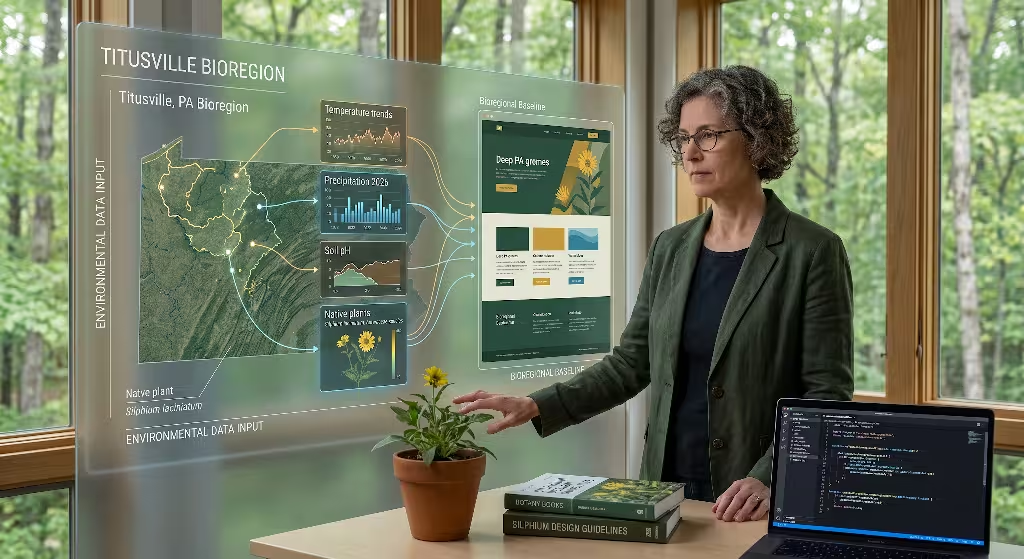
Every geographic area on earth has its own distinct climate, plant life, daylight patterns, and seasonal rhythm. These environmental factors create a biological baseline that quietly guides human mood, energy levels, and daily habits. A person living through a cold, dark winter in Maine experiences completely different daily pressures than someone living along the sunny coast of Southern California.
These environmental conditions directly influence how people interact with websites. When outdoor weather shifts suddenly, user priorities shift with it. A severe storm, a heatwave, or an early seasonal freeze changes what people search for, what products they need, and how long they are willing to read an article. A user location provides vital clues about these environmental baselines.
When digital systems recognize a user location, they can subtly adapt to match these natural rhythms. For instance, adjusting visual brightness, highlighting seasonally appropriate information, or referencing regional materials makes a digital space feel grounded in reality. Rather than forcing the visitor to adapt to an artificial online environment, the website honors the visitor’s local ecosystem.
Basic Idea: Aligning Digital Delivery with Spatial Reality
The central rule of modern web design is straightforward: content disconnected from physical context creates user friction, while content aligned with physical context drives superior engagement.
When a digital platform ignores a user location, it forces the human brain to do extra work. The visitor must manually check if shipping is available, convert currencies, filter out irrelevant regional laws, and decipher whether a service applies to their territory. Every extra step creates an opportunity for frustration, causing visitors to abandon the page.
Conversely, when a platform uses the user location to tailor the experience, user satisfaction rises across every key metric. Dwell time increases because the information is instantly usable. Bounce rates drop because the user feels recognized. Conversion rates climb because local barriers to action are removed before the user even encounters them. Aligning digital delivery with the spatial reality of the user location transforms a cold, generic website into an active, responsive environment.
Client-Side versus Edge Resolution
To build a website that adapts to a user location, engineers must choose how to detect where a visitor is located. There are two primary technical approaches: client-side detection and edge network resolution.
Client-side detection relies on tools built directly into the visitor’s web browser, such as the HTML5 Geolocation API. When a site uses this method, the browser displays a popup window asking the visitor for permission to share their exact GPS coordinates. While this method can pinpoint a user location down to a few feet, it introduces severe friction. Most visitors decline the prompt because they find it intrusive or alarming. Furthermore, waiting for the user to click “Allow” introduces a noticeable delay before the page can customize its layout.
+-------------------------------------------------------------------+
|                     LOCATION DETECTION MODELS                     |
+----------------------------------+--------------------------------+
| CLIENT-SIDE RESOLUTION           | EDGE NETWORK RESOLUTION        |
+----------------------------------+--------------------------------+
| * Runs inside user's browser     | * Runs at nearest CDN node     |
| * Requires invasive permission   | * Passive, zero-friction       |
| * High latency (waits for prompt)| * Ultra-fast sub-millisecond   |
| * Exact GPS lat/long precision   | * City, region, or country     |
| * High user drop-off rate        | * High completion rate         |
+----------------------------------+--------------------------------+
Edge network resolution offers a faster, smoother alternative. When a browser requests a webpage, that request passes through a Content Delivery Network (CDN) server located close to the visitor. The edge server inspects the incoming network request and identifies the user location based on the visitor’s IP address. This lookup happens in less than a millisecond at the network perimeter. The edge server can then insert city, state, or country headers into the web request before the page even finishes loading.
Because edge resolution happens passively in the background, it requires zero browser prompts and adds no visible delay. While IP-based edge detection identifies a user location at the city or regional level rather than pinpointing an exact street address, that regional precision is almost always ideal for tailoring web content without invading privacy.
Latency Budgets and Performance
Speed is a critical component of user engagement. If a webpage takes too long to load or jumps around while rendering, visitors leave immediately. Search engines also penalize slow sites. Therefore, any system designed to customize content based on a user location must operate within a strict latency budget.
When a server takes too long to calculate a user location, it increases Time to First Byte (TTFB), which is the time a browser must wait before receiving the first piece of page data. If a site waits to load the entire page and then uses client-side JavaScript to swap out text based on the user location, the visitor will see the page suddenly jump or shift. This visual instability is known as Cumulative Layout Shift (CLS), and it creates an unpleasant, disorienting experience.
To maintain perfect performance, engineering teams push location logic to edge nodes. Edge computing allows servers to determine the user location and inject the correct localized components during the initial data stream. By handling the user location at the edge, the website delivers a lightning-fast initial render with zero layout shift, ensuring that performance optimizations and personalization work together seamlessly.
Architectural Trade-Offs in Location Detection
Every method for determining a user location comes with engineering trade-offs between precision, speed, privacy, and complexity. Choosing the right architecture depends entirely on what the user needs to accomplish on the page.
| Resolution Method | Precision Level | User Action Required | Latency Impact | Best Use Case |
| Edge IP Header (CDN) | City or Region | None (Passive lookup) | Extremely low (< 5ms) | Regional news, localized headlines, weather themes |
| HTML5 Geolocation API | Exact GPS Coordinates | Explicit click on browser popup | High and unpredictable | Turn-by-turn navigation, immediate local delivery tracking |
| Declared Postal Code | Neighborhood or Zip Code | User types into form input | Zero after form entry | Hyper-local inventory lookup, municipal services |
| Cell Tower / Wi-Fi Triangulation | Urban Block | Native app permissions | Moderate | Mobile applications, transit schedules |
For general content publishing and informational websites, edge IP lookups offer the best balance. They provide sufficient accuracy to understand the user location without introducing annoying permission banners or slowing down page rendering. If a website requires street-level precision, such as a localized mapping tool, asking for explicit coordinates via the browser API becomes necessary, but that friction should only be introduced when the user clearly asks for a spatial service.
Click-Through Rate and Regional Relevance

A reader’s decision to click on a link, article, or button is driven by perceived relevance. When digital headlines or featured cards reflect the vocabulary, landmarks, or current conditions of the user location, click-through rates rise substantially.
Consider an environmental news publication. A generic headline might read: “New Water Conservation Rules Announced for Homeowners.” A visitor scrolling through a feed may easily pass that by. However, if the site uses the user location to dynamically adapt the title to read: “New Water Conservation Rules Announced for Allegheny Watershed Residents,” the reader immediately recognizes that the article affects their daily life.
This lift in click-through rate occurs because the human brain is wired to pay attention to nearby events. By reflecting the user location in page teasers, navigation menus, and callout banners, websites signal immediate utility. The visitor does not have to guess whether the information applies to their community, which makes clicking the natural choice.
Dwell Time, Scroll Depth, and the Mirror Effect
Once a visitor lands on a page, the next challenge is keeping them engaged. Two primary metrics reveal whether content is truly resonating: dwell time (how long someone stays on the page) and scroll depth (how far down the page they read). Adapting content to a user location improves both numbers through a psychological phenomenon known as the mirror effect.
The mirror effect describes our natural tendency to engage more deeply with content that reflects our own environment, identity, and daily realities. When a user opens an article and sees photographs of plant life, architectural styles, or landscapes native to their user location, they feel an instinctive sense of familiarity.
Conversely, if an article about residential gardening uses photos of palm trees when the user is sitting in a snowy northern climate, the visual disconnect breaks immersion. The reader feels alienated and quickly bounces back to the search results.
When body text, case studies, and visual elements mirror the user location, readers stay longer and scroll deeper. They recognize that the material was curated for their world, which builds trust and encourages them to read all the way to the end of the page.
Conversion Rate Optimization Across Territories

For commercial and service-oriented websites, engagement ultimately culminates in conversion, whether that means completing a purchase, signing a petition, or subscribing to a newsletter. A user location has an enormous impact on whether a visitor completes that final action.
Conversion friction often stems from small regional uncertainties. When a user is ready to buy a product, their mind asks several quick questions:
- Is this item available to ship to my home?
- Will I be charged unexpected international customs fees?
- Is this price shown in my local currency?
- Does this service comply with the legal regulations in my state or province?
If a website forces the visitor to search for shipping policies or calculate currency conversions manually, the sale is frequently lost. By detecting the user location automatically, the site can answer those questions immediately.
Displaying native currency, calculating exact regional tax rates, and confirming product availability based on the nearest warehouse removes doubt. Tailoring call-to-action buttons to reference the user location directly, such as “Find a Certified Installer in Pennsylvania,” consistently yields higher conversion rates than a vague “Find an Installer” button.
Return Frequency and Persistent Local Utility
One-time engagement is valuable, but long-term success requires bringing readers back repeatedly. A website that consistently accounts for a user location transforms from a simple static reading page into an indispensable regional utility.
When a digital platform saves a visitor’s geographic preferences and delivers ongoing local value, it builds strong habits. For example, a home gardening portal that provides frost warnings, native planting calendars, and soil alerts matched to the specific user location becomes a daily resource. The user returns because the site acts as an attentive local companion.
Creating persistent utility requires respecting user choices. If a site detects a user location but the visitor manually selects a different region from a dropdown menu, the system must store that preference and remember it across future visits. When a site combines smart detection with user choice, return visits climb steadily over time.
Macro-Localization: Language, Culture, and Currency
Adapting digital experiences to a user location happens on two levels: macro-localization and micro-context. Macro-localization deals with broad, foundational cultural structures, including national languages, regional dialects, currencies, and legal systems.
When expanding a digital presence internationally, simple word-for-word translation is rarely enough. True macro-localization adjusts idioms, date formats, measurement systems, and cultural references to match the user location. For example, while both the United States and the United Kingdom use English, differences in spelling, phrasing, and measurement units (metric versus imperial) immediately signal whether a site was built for a local audience.
+--------------------------------------------------------------------+
|                    LEVELS OF GEO-PERSONALIZATION                   |
+----------------------------------+---------------------------------+
| MACRO-LOCALIZATION               | MICRO-CONTEXTUAL ALIGNMENT      |
+----------------------------------+---------------------------------+
| * National language and dialects | * Real-time weather integration |
| * Official currency formats      | * Daylight and circadian cycles |
| * Metric vs. imperial units      | * Native flora and fauna imagery|
| * Legal and tax disclosures      | * Regional materials and design |
| * Hreflang technical routing     | * Hyper-local environmental cues|
+----------------------------------+---------------------------------+
From an engineering standpoint, macro-localization requires clean site architecture. Technical teams must implement accurate hreflang tags in the HTML header so search engines understand which page version corresponds to which user location and language. Furthermore, currency symbols and tax disclosures must update automatically based on the detected country or state, eliminating confusion at checkout.
Micro-Context and Environmental Alignment
While macro-localization handles broad national differences, micro-context focuses on immediate environmental conditions. This is where biophilic design and modern web development intersect in powerful ways. Micro-contextual design uses the user location to harmonize the digital interface with the physical atmosphere outside the user’s window.
A website can read real-time environmental data for a user location to adjust its styling and content presentation:
- Daylight and Circadian Rhythms: Transitioning color palettes from crisp daylight tones to warm, low-glare evening hues based on local sunset times at the user location helps reduce eye strain.
- Weather Integration: Subtly reflecting local weather, such as featuring rain gear during a local downpour or shifting background illustrations to match regional seasons, establishes a deep subconscious bond with the reader.
- Bioregional Assets: Incorporating illustrations, botanical photography, and textures that represent the local flora, rock formations, and geography of the user location creates an organic, welcoming atmosphere.
These subtle touches make the screen feel alive. Instead of interacting with a sterile, disconnected server, the visitor experiences a digital canvas that breathes in sync with their natural surroundings.
Information Architecture Adjustments
Information architecture refers to the way content is organized, structured, and labeled on a website. A user location can be used to dynamically reorder menus and navigation links to place the most relevant information within easy reach.
User intent often varies dramatically by geography. For example, visitors browsing an outdoor apparel site from a mountainous user location in Colorado may search predominantly for rock climbing and high-altitude hiking gear. At the exact same time, visitors browsing from coastal Florida are likely searching for lightweight water-repellent clothing and sun protection.
                  +--------------------------------+
                  | INCOMING USER REQUEST AT EDGE  |
                  +---------------+----------------+
                                  |
                   [Inspect Edge Location Header]
                                  |
            +---------------------+---------------------+
            |                                           |
    [User in Colorado]                          [User in Florida]
            |                                           |
+-----------v-----------+                   +-----------v-----------+
| DYNAMIC NAVIGATION:   |                   | DYNAMIC NAVIGATION:   |
| 1. Alpine Trail Gear  |                   | 1. Sun & UV Apparel   |
| 2. Thermal Layers     |                   | 2. Water Sports Gear  |
| 3. Climbing Ropes     |                   | 3. Lightweight Packs  |
+-----------------------+                   +-----------------------+
By analyzing behavioral patterns across different territories, engineers can configure the website navigation to prioritize categories that match the regional demand of the user location. Placing the most relevant categories at the top of the menu saves users time, cuts down on unnecessary clicks, and keeps visitors moving smoothly toward their goals.
How Does User Location Affect Website Engagement?
When analyzing web metrics, the relationship between a user location and digital engagement is clear: geographic relevance directly lowers cognitive friction and increases user trust.
When a visitor arrives on a page that immediately answers questions specific to their user location, their brain enters a state of ease. They do not need to scan through paragraphs of disclaimers to find out if the content applies to their city or province. Because the page satisfies their intent instantly, the bounce rate drops significantly.
Furthermore, users are far more likely to share content that highlights their local community. Articles that address regional environmental concerns, local municipal updates, or community developments generate higher social engagement and deeper commentary than generic global overviews. Recognizing the user location turns passive readers into active participants.
What Is Geo-Targeting and Why Is It Critical for Content Strategy?
Geo-targeting is the deliberate practice of delivering customized digital content, advertisements, and website experiences to visitors based on their physical user location. It forms the backbone of modern content strategy because audience needs are rarely uniform.
There are two primary forms of geo-targeting:
- Passive Geo-Targeting: The web server reads network signals to detect the user location automatically, tailoring background assets, currency displays, and regional headlines without requiring user intervention.
- Active Geo-Targeting: The website invites the user to select their location or enter a postal code, enabling deep, hyper-local personalization for complex services.
Geo-targeting is critical because it prevents wasted effort. Delivering marketing campaigns or detailed guides that are irrelevant to a particular user location damages brand credibility. By tailoring content pipelines to specific geographic clusters, organizations ensure that every piece of content reaches the audience most equipped to act upon it.
Does Dynamic Localized Content Hurt or Help SEO Rankings?
A common concern among technical directors is whether changing content based on a user location will harm search engine optimization (SEO) rankings. If handled incorrectly, dynamic personalization can confuse search engine crawlers. However, with the right technical safeguards, localized content significantly boosts organic visibility.
Search engine crawlers, such as Googlebot, predominantly browse websites from IP addresses based in the United States. If a server automatically redirects every visitor based strictly on IP detection without providing fallback paths, search crawlers may never discover the content versions built for other parts of the world.
To optimize dynamic localization for search engines without creating indexing errors, development teams must follow established technical standards:
- Avoid Forced IP Redirects: Never trap users or bots behind forced redirects based on IP detection. Always allow crawlers and visitors to access any regional variation via clean, crawlable URLs (such as
/us/,/ca/, or/uk/). - Use Hreflang Tags Correctly: Add complete
hreflangannotations to the page headers to inform search engines exactly which URL corresponds to each specific language and user location. - Serve Proper Cache Headers: When serving different content from the exact same URL based on geographic headers, include the
Vary: Accept-Languageor appropriate cache-control headers so intermediate proxy caches do not serve the wrong regional page to visitors. - Provide Static Fallbacks: Ensure that the default version of the page contains clear, crawlable links to every regional directory, allowing search engine bots to index all localized assets easily.
When built using these standards, location-aware websites perform exceptionally well in organic search because they satisfy local search intent with pinpoint precision.
What Are the Key Privacy Constraints for Location-Based Personalization?
While tailoring experiences to a user location offers huge benefits, privacy must remain the top priority. Users and regulatory bodies rightly demand transparency regarding how geographic data is collected, processed, and stored.
The core rule of ethical location personalization is data minimization: collect only the minimum level of geographic detail necessary to deliver the requested service. Content publishers almost never need a visitor’s exact street address or precise latitude and longitude coordinates. Relying on coarse location data, such as the visitor’s general city or state, satisfies design requirements while fully protecting personal privacy.
Websites must also provide clear, accessible privacy policies explaining how location signals are handled. If a site uses precision browser APIs, it must obtain explicit user consent before activating those sensors. Transparent, respectful handling of the user location builds long-term user trust and keeps the organization on solid legal footing.
Regulatory Landscape: Coarse versus Fine Geolocation
Global privacy legislation establishes a clear distinction between coarse geographic data and fine geographic data. Understanding these legal boundaries is essential for any engineering team building location-aware systems.
+-------------------------------------------------------------------+
|                  GEOGRAPHIC DATA PRIVACY TIERS                    |
+---------------------------------+---------------------------------+
| COARSE GEOLOCATION DATA         | FINE GEOLOCATION DATA           |
+---------------------------------+---------------------------------+
| * Country, State, City level    | * Exact GPS lat/long points     |
| * Derived from general IP lookup| * Sensor-derived coordinates    |
| * Low regulatory restriction    | * Heavily regulated (GDPR/CPRA) |
| * Zero opt-in prompt required   | * Requires explicit user opt-in |
| * Ideal for content design      | * Strict retention limits apply |
+---------------------------------+---------------------------------+
Under major privacy frameworks, such as the European Union’s General Data Protection Regulation (GDPR) and the California Consumer Privacy Act / California Privacy Rights Act (CCPA/CPRA), precise geolocation (fine data) is classified as sensitive personal information. Storing precise GPS coordinates requires explicit opt-in consent, strict data retention limits, and robust security protocols.
In contrast, coarse geographic data derived from IP lookups at the country, state, or city level does not identify an individual person. It allows systems to adapt the presentation layer to the user location safely without triggering onerous regulatory burdens or compromising user anonymity.
Graceful Degradation and Privacy-Hardened Browsing
A significant portion of web traffic uses privacy-hardened browsers, Virtual Private Networks (VPNs), Apple iCloud Private Relay, or the Tor network. These technologies intentionally mask or alter the visitor’s apparent IP address, making automated detection of the true user location impossible or inaccurate.
A resilient website must be designed with graceful degradation in mind. The system should never break, freeze, or display empty content containers simply because it cannot determine the user location.
When location signals are missing or conflicting, the platform should smoothly fall back to a clean, universally appealing baseline experience. In these situations, subtle interface cues, such as a compact region selector in the header, allow the user to voluntarily indicate their preferred location. Graceful degradation guarantees that privacy-conscious users receive a fast, beautiful experience without any technical errors.
Zero-Party Location Capture
The most respectful and accurate way to understand a user location is simply to ask the visitor to share it voluntarily. This is known as zero-party data: information that a user intentionally and proactively provides to a website.
Rather than relying on silent tracking scripts, thoughtful web design uses elegant user interface components to invite location input:
- Interactive Region Selectors: A well-designed dropdown menu or lightweight modal overlay in the header allows visitors to pick their preferred state or country in a single click.
- Postal Code Lookups: For services requiring neighborhood-level detail, such as checking local inventory or finding nearby community events, providing a clean text box for zip code entry is clear, fast, and respectful.
- Contextual Prompts: Asking for location at the exact moment it provides value (for instance: “Enter your city to see native butterfly host plants in your area”) achieves high completion rates because the benefit to the user is obvious.
Zero-party location capture avoids all tracking ambiguities. It gives the visitor full control over their experience, eliminates privacy compliance headaches, and ensures that the platform delivers content aligned with the user location they actually care about.
Headless CMS and Edge Delivery Architecture
Delivering dynamic, location-tailored experiences without sacrificing performance requires modern web architecture. A headless Content Management System (CMS) paired with edge computing middleware provides the ideal foundation.
In a headless architecture, content is created and stored independently from the visual presentation layer. Structured content fields can be tagged with regional attributes within the CMS. When a visitor requests a page, edge middleware (such as Cloudflare Workers, Fastly Compute, or Vercel Edge Middleware) intercepts the request at the nearest network server.
                           +------------------------+
                           |  HEADLESS CMS REPO     |
                           |  (Structured Content)  |
                           +-----------+------------+
                                       |
                                [Content Stream]
                                       |
+------------------+       +-----------v------------+       +------------------+
| VISITOR BROWSER  | <---> | EDGE CDN MIDDLEWARE    | <---> | ORIGIN SERVER    |
| (Receives Fast,  |       | * Detects Location     |       | (Static Shell &  |
| Localized HTML)  |       | * Rewrites DOM at Edge |       | Base Assets)     |
+------------------+       +------------------------+       +------------------+
The edge worker reads the user location headers and dynamically rewrites the incoming HTML stream before sending it down to the visitor’s browser. It swaps in the correct regional titles, local imagery, and relevant case studies in real time. Because this DOM rewriting happens entirely on the edge server, the browser receives a complete, fully formed HTML document. There are no client-side rendering delays, no awkward layout shifts, and no heavy client scripts bogging down the visitor’s device.
Testing and Measurement: Analytics and Controlled Experiments
To verify the positive impact of location adaptation, teams must establish robust analytics frameworks and run carefully structured experiments.
Standard web analytics often group all visitors into a single generic bucket. To understand how place influences behavior, analytics platforms (such as Matomo or GA4) should be configured with custom dimensions that track performance across distinct geographic cohorts. Comparing dwell time, scroll depth, and goal completions across different regions reveals where localization is succeeding and where content needs refinement.
When conducting A/B split tests on location-adaptive elements, engineers must ensure that testing variants are assigned consistently:
- Edge-Based Test Allocation: Assign test variants at the edge server to prevent flickering or layout shifts between the generic control and the localized variant.
- Segment Isolation: Test localized content against generic content within the same geographic segment. Comparing a localized experience in California against a generic experience in Ohio introduces weather and cultural biases; the test must compare localized versus generic delivery within the identical user location.
- Conversion Guardrails: Monitor technical performance metrics (like TTFB and First Contentful Paint) alongside business metrics during tests to guarantee that personalization logic never degrades baseline site speed.
Rigorous testing transforms location personalization from an intuitive design concept into a verified, data-backed engine for user engagement.
The physical environment we inhabit shapes our minds, our focus, and our daily needs. When web architecture respects this reality by harmonizing content delivery with the user location, digital spaces become significantly more intuitive, engaging, and enduring. By pairing passive edge resolution, biophilic micro-context, respectful zero-party input, and rigorous performance engineering, modern websites can bridge the gap between physical place and digital space.