The natural world has a term for the unique environmental factors that give a wine its distinct character: terroir. The soil, the climate, the angle of the sun, and the surrounding flora all impart a sense of place that cannot be replicated elsewhere.
In the digital world, a similar concept is emerging, one that I call “Digital Terroir.” It is the idea that a user’s physical location and environment profoundly shape their online interactions. Understanding this geographic context is no longer a niche tactic for marketers but a fundamental component of effective digital strategy, user experience, and even biophilic web design. The geographic data that paints this picture provides the essential context, revealing not just who a user is, but where, when, and why they are engaging.
This article will deconstruct the critical role of geographic data in analyzing and predicting user behavior, showing how mapping the user’s real world location allows us to build more intuitive, responsive, and ultimately more human digital experiences.
Table of Contents
What is Geographic Data? The Foundational Layers of Location Intelligence
At its core, geographic data, also known as geodata or spatial data, is simply information that identifies a specific location on Earth. Think of it as the digital address for a person, a device, or an event. This information is the bedrock of what we call location intelligence. It comes in many forms and is collected through various methods, which can be thought of like geological strata. Each layer, from the broadest to the most specific, adds richness and detail to our understanding of the user.
We can separate the collection of geographic data into two main categories: active and passive.
Active data is information that users provide willingly and consciously. When you fill out a shipping address to receive a package, enter your city to find local movie times, or “check in” to a restaurant on social media, you are actively sharing your geographic data. This type of data is valuable because it is explicit and has a high degree of accuracy for its intended purpose. The user is telling you directly, “This is where I am,” or “This is a place that matters to me.”
Passive data, on the other hand, is generated by our devices without our direct, moment to moment input, based on permissions we have granted. This is where the layers become more complex and powerful.
- IP Address Geolocation: Every device connected to the internet has an Internet Protocol (IP) address. This address can be traced to a general location, usually at the country, state, or city level. It’s the broadest layer of geographic data, like identifying the continent a rock came from. It’s not precise enough to know a user’s street, but it’s excellent for customizing a website’s language, currency, or showing region specific content.
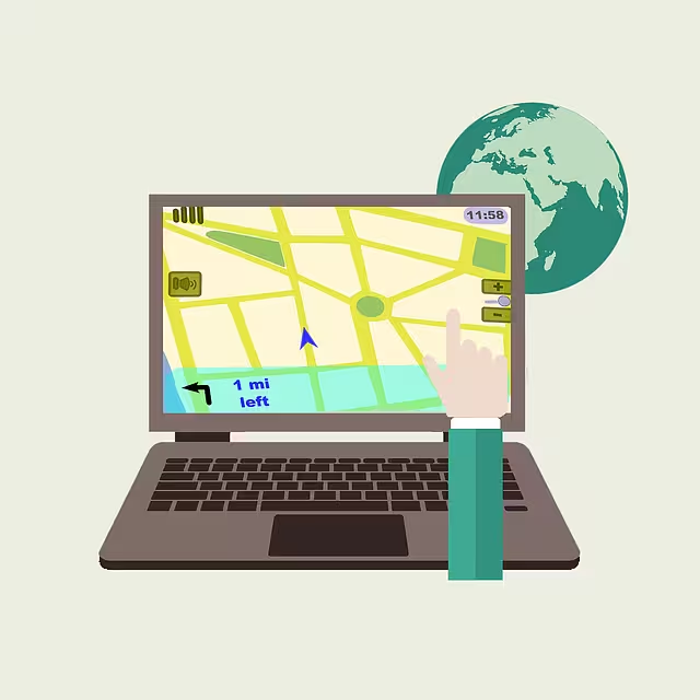
- GPS Data: The Global Positioning System provides the most precise layer of geographic data available. Satellites orbiting the Earth transmit signals that smartphones and other GPS enabled devices can receive. By calculating the time it takes for signals from multiple satellites to reach the device, its exact latitude and longitude can be determined, often within a few feet. This is the fine grained topsoil of location data, offering incredible detail about a user’s movements and location.
- Wi-Fi and Bluetooth Beacons: In dense urban areas or inside large buildings like malls and airports, GPS signals can be weak. Here, Wi-Fi networks and small, low energy Bluetooth devices called beacons can be used to pinpoint a user’s location. A smartphone can estimate its position based on the strength of signals from nearby Wi-Fi routers or beacons. This method of collecting geographic data is key for understanding indoor behavior.
- Cell Tower Triangulation: Your mobile phone is always communicating with nearby cell towers. By measuring the signal strength from three or more towers, a service provider can triangulate a device’s general location. It is less precise than GPS but provides a reliable way to get a general sense of a user’s location, especially in areas where other signals are unavailable.
These different types of geographic data are rarely used in isolation. They are often combined to create a comprehensive and layered portrait of a user’s location and movement. This powerful combination of information, supported by technologies like the Google Maps API and open source projects like OpenStreetMap, is what allows businesses to move beyond simple demographics and begin to understand the rich, location based context of user behavior.
The Core Symbiosis: Connecting Location to Action and Intent

Understanding a user’s location is powerful, but the true value of geographic data is unlocked when we connect it to their actions and infer their intent. Location provides the “why” behind the “what.” It moves analysis beyond knowing who the user is to understanding where and when they are, which provides critical context for their online behavior. This connection is a symbiotic relationship; the location gives meaning to the action, and the action gives value to the location.
This relationship reveals several key patterns. First, geographic data uncovers profound cultural and regional nuances. A user searching for “boots” in Boston in October has a very different intent than a user searching for the same term in Miami. The Boston user is likely looking for warm, waterproof footwear for the coming winter, while the Miami user might be interested in fashion boots.
Without geographic data, these two users are identical. With it, a smart e-commerce platform can show the Boston user insulated boots and the Miami user stylish ankle boots, dramatically improving the user experience and increasing the likelihood of a sale. These regional differences apply to language, product preferences, and even the imagery that resonates most effectively.
Second, geographic data allows businesses to react to real time environmental triggers. Imagine a sudden downpour in a major city. Users in that area might suddenly start searching for umbrellas, raincoats, or indoor activities. A delivery service could promote hot soup, while a ride sharing app could anticipate a surge in demand. These are not behaviors that can be predicted by a user’s age or past purchases alone; they are a direct response to the user’s immediate physical environment. By monitoring real time geographic data alongside other data points like weather patterns or local event schedules, businesses can be incredibly agile and relevant.
Finally, neighborhood level geographic data can offer valuable socioeconomic indicators. While we must be careful to avoid making unfair assumptions about individuals, aggregated data can reveal patterns. For instance, the residents of a certain zip code might show a higher interest in luxury goods, while another might be more responsive to budget friendly promotions. This information, when used responsibly, can help businesses tailor their product offerings, pricing, and messaging to better serve the needs and preferences of different communities. This deep understanding of local context is a key benefit of analyzing geographic data.
The predictive power of this symbiosis is immense. By analyzing historical geographic data, such as a user’s daily commute, their favorite coffee shop, or the parks they visit on weekends, companies can use a process called spatial analysis to predict future needs. If a user consistently stops at a grocery store on their way home from work, a mapping application could proactively suggest a route that avoids traffic near that store. This is the power of geographic data: it bridges the gap between the digital and physical worlds, allowing us to understand and even anticipate user behavior in a way that was never before possible.
Practical Applications: Translating Geographic Insights into Digital Strategy
Understanding the theory behind geographic data is one thing; applying it is another. The insights gleaned from location intelligence can be translated into concrete strategies across a wide range of business functions, from marketing to user experience to market research. These applications are what turn raw geographic data into tangible business value.
Hyper-Personalization and UX Optimization
One of the most immediate and impactful uses of geographic data is in creating hyper personalized user experiences. Instead of serving a one size fits all website to every visitor, companies can dynamically alter the content based on the user’s location. This can be as simple as automatically displaying the correct language and currency or as sophisticated as changing the entire visual theme of the site. A travel website, for example, could greet a user from a cold, rainy London with images of sunny beaches, while showing a user from Arizona images of cool mountain getaways.
This practice has a direct link to the principles of biophilic design, which seeks to connect people with nature. A core tenet of this philosophy is creating “Place Based Relationships.” We are intrinsically connected to our local environments. A website that reflects this connection feels more natural and intuitive. Imagine a home and garden website that features articles and products relevant to the user’s specific climate zone, or a news site that prioritizes local stories. By using geographic data to create a sense of place, we make the digital experience feel less generic and more grounded in the user’s real world reality. This creates a stronger, more positive connection between the user and the brand.
Geotargeting for Marketing and Local SEO
Perhaps the most well known application of geographic data is in marketing. Geotargeting allows businesses to deliver location specific advertisements and content to users in a defined area. This could be an entire country, a single city, or even a one block radius around a physical store. This is the engine behind hyperlocal marketing. A local pizzeria can show ads for its lunch special only to people within a two mile radius during the hours of 11 AM to 2 PM. This level of precision is incredibly efficient, ensuring that marketing budgets are spent reaching the most relevant audience.
This strategy is also crucial for Local Search Engine Optimization (SEO). A huge number of Google searches have local intent, such as “coffee shops near me” or “best plumber in Boston.” To capture this traffic, businesses must optimize their online presence for specific locations. This includes creating a detailed Google Business Profile, building location specific landing pages on their website, and ensuring their name, address, and phone number are consistent across the web.
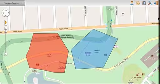
High quality geographic data is essential for understanding where potential customers are searching from and what local keywords they are using. Related concepts here include geofencing, which involves setting up a virtual boundary that triggers an action (like sending a notification) when a user enters or exits, and a broader understanding of consumer behavior as it relates to physical location.
Market Research and Competitive Analysis
Geographic data is a goldmine for market research. By visualizing customer data on a map, businesses can identify key patterns that would be invisible in a spreadsheet. This is often done using powerful Geographic Information Systems (GIS) software from companies like Esri, or with data visualization tools like Tableau. A company could map the addresses of its current customers to see where they are concentrated, revealing hot spots of high demand.
This same analysis can identify underserved markets. If a map shows a large, populated area with very few customers, it could represent a significant growth opportunity. Is there a lack of awareness in that area? Or are there local competitors who are better meeting the needs of that community? Speaking of which, geographic data is also invaluable for competitive analysis. By mapping out competitor locations, a business can analyze their physical footprint, identify areas where the market is saturated, and find strategic locations for new stores or targeted marketing campaigns. This spatial view of the market provides a powerful strategic advantage.
Security and Fraud Prevention
Finally, a less obvious but critically important application of geographic data is in security and fraud prevention. When you log into your bank account, the bank often checks your IP address. If you are logging in from your home in Chicago, and then two minutes later an attempt is made from a different continent, the system can flag this as a suspicious activity and require additional verification. This simple use of geographic data provides a powerful first line of defense against unauthorized account access and financial fraud.
The Ethical Ecosystem: Navigating Privacy, Trust, and Digital Stewardship

The power of geographic data comes with significant responsibility. The same information that allows a business to offer a helpful, personalized experience can also be used in ways that feel intrusive or violate a user’s privacy. The precision of GPS data, in particular, can reveal incredibly intimate details about a person’s life, from their home address and place of work to their daily habits and social connections. Therefore, navigating the ethical ecosystem surrounding geographic data with transparency and respect is not just a legal requirement; it is a business imperative.
Public awareness of data privacy issues has grown significantly, leading to the creation of robust regulatory frameworks. The two most prominent examples are Europe’s GDPR (General Data Protection Regulation) and the CCPA (California Consumer Privacy Act). While their specific rules differ, they share a common goal: to give individuals more control over their personal data. These laws require businesses to be transparent about what data they are collecting, to have a legitimate reason for collecting it, and to obtain clear consent from the user. They also give users the right to access, correct, and delete their data. Any organization that handles the geographic data of users in these regions must comply with these regulations or face steep penalties.
Beyond legal compliance, however, is the crucial issue of building user trust. Trust is a fragile commodity in the digital world. Once broken, it is incredibly difficult to repair. The key to building and maintaining trust is a commitment to ethical data stewardship, which rests on three pillars.
- Transparency: Businesses must be upfront and clear about how they use geographic data. This means avoiding confusing jargon and lengthy legal documents. Instead, use simple, easy to understand language to explain what data is being collected and, just as importantly, why. If you are using location to personalize content, say so. If you are using it for security, explain how.
- Value Exchange: Users are generally willing to share their geographic data if they receive a tangible benefit in return. A mapping app that needs your location to provide directions is a clear and fair value exchange. A social media app that tracks your location 24/7 just to serve you more ads is not. The exchange must feel balanced and fair to the user. The benefit they receive should clearly outweigh the data they are sharing.
- Anonymization and Aggregation: For many analytical purposes, it is not necessary to know the identity of a specific individual. Businesses should, wherever possible, use aggregated and anonymized geographic data. This means grouping data from many users together to identify broad trends without being able to single out any one person. For example, knowing that “5,000 people visited this mall on Saturday” is a valuable market research insight that does not compromise the privacy of any individual shopper.
By embracing these principles, companies can use geographic data responsibly, creating a win win situation where businesses gain valuable insights and users receive better, safer, and more relevant digital experiences.
Conclusion: The Future is Contextual
We have seen that geographic data is far more than just a set of coordinates on a map. It is the essential context that transforms abstract user metrics into a vivid, actionable picture of human behavior. It provides the “Digital Terroir” that gives each user’s online journey a unique and understandable shape. From broad, city level IP data to the hyper precise detail of GPS, each layer of geographic data helps us understand the physical environment that influences a user’s digital life.
This understanding allows us to move beyond generic, one size fits all approaches and build digital strategies that are personalized, relevant, and respectful. We can tailor marketing messages to local cultures, optimize user experiences based on real time environmental triggers, conduct insightful market research, and enhance security. The immense value of geographic data is clear.
However, this power must be wielded with a deep and unwavering commitment to ethical stewardship. User trust is the foundation of the digital economy, and it depends on transparency, a fair value exchange, and a respect for privacy. The future of web design and digital strategy lies in creating seamless, intuitive experiences. By understanding a user’s “digital biome,” we can design online environments that are not just functional but feel naturally attuned to their real world context. This approach will foster a more organic, positive, and lasting connection between brands and the people they serve. The map of the future is not just about places; it is about people, and geographic data is the key to understanding it.