In the digital realm, where user experience reigns supreme, every design choice is a calculated decision. Among the most impactful of these is the website’s background. It sets the stage, establishes a mood, and can either enhance or detract from the user’s journey. Two compelling choices have emerged from the world of cartography: the intricate lines of a topographic map and the stunning realism of a satellite image.
This article will analyze both options, providing a definitive guide to help you decide which is the superior choice for your website. We will explore how a topographic map, with its elegant contours, can bring a subtle, data-driven aesthetic to your design. We will also delve into the world of satellite imagery, examining its power to evoke emotion and provide context. By the end of this analysis, you will have a clear understanding of which choice will best serve your users and your brand.
Table of Contents
Understanding Topographic Maps in Web Design
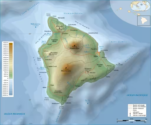
A topographic map is a two-dimensional representation of a three-dimensional landscape. Unlike a standard map that only shows roads and political boundaries, a topographic map provides detailed information about the shape of the land. It uses contour lines to show changes in elevation, giving you a sense of the terrain’s peaks and valleys. The closer the contour lines, the steeper the slope. The further apart they are, the flatter the terrain.
This method of representing the earth’s surface is not just for hikers and geologists; it has found a unique place in the world of web design. The aesthetic of a topographic map is one of precision and data. It can lend a website a sophisticated and analytical feel, making it an excellent choice for brands in the tech, engineering, and outdoor industries. A well-executed topographic map background can create a sense of place and adventure, without overwhelming the user with unnecessary visual information.
The beauty of a topographic map in web design lies in its subtlety. It can be a quiet, unassuming background that allows the foreground content to shine. The muted color palettes often found in a topographic map are easy on the eyes and provide an excellent canvas for text and other design elements. This is a crucial consideration for user experience, as readability is paramount. A website that is difficult to read will quickly be abandoned, no matter how beautiful its design. A topographic map background, when used correctly, can enhance readability and create a harmonious and balanced design.
Furthermore, a topographic map can be a powerful branding tool. For a company that sells outdoor gear, a topographic map of a famous mountain range can instantly connect with its target audience. It speaks to a shared passion for exploration and adventure. For a tech company, a topographic map of a city can represent the complex data landscapes they navigate.
The versatility of the topographic map is one of its greatest strengths. It can be customized to fit a wide range of brand identities, from the rugged and adventurous to the sleek and modern. The abstract nature of a topographic map also allows for creative interpretation. It can be stylized and colorized to match a brand’s color palette, creating a unique and memorable design element. A topographic map is not just a background; it is a statement.
The Role of Satellite Imagery as a Website Background
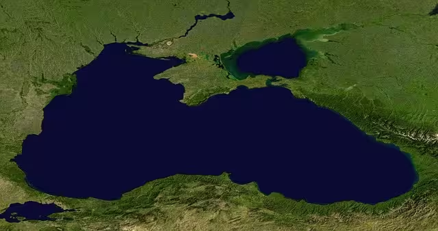
Satellite imagery, on the other hand, offers a completely different aesthetic. It is a photorealistic representation of the Earth’s surface, captured from space. It can be breathtakingly beautiful, showcasing the world in all its natural glory. From the swirling blues of the ocean to the rugged textures of a mountain range, satellite imagery can evoke a powerful emotional response.
This is its greatest strength in web design. It can instantly transport the user to another place, creating a sense of wonder and awe. For a travel website, a stunning satellite image of a tropical island can be a powerful sales tool. For an environmental organization, a satellite image of a shrinking glacier can be a stark and moving call to action.
However, the power of satellite imagery also comes with its own set of challenges. The high level of detail and color in a satellite image can be distracting. It can compete with the foreground content for the user’s attention, making it difficult to read text and find important information. This can be a major usability issue, as a website that is difficult to navigate is a frustrating experience for the user. To use satellite imagery effectively, designers must employ techniques such as color overlays and blur effects to reduce the visual noise and create a clear hierarchy. This requires a delicate balance, as too much alteration can diminish the impact of the image.
Another major consideration when using satellite imagery is performance. High-resolution images can be very large files, which can significantly slow down a website’s loading speed. In today’s fast-paced digital world, users have little patience for slow websites. A website that takes too long to load is likely to be abandoned, resulting in a high bounce rate and a negative impact on search engine rankings. To mitigate this, designers must carefully optimize satellite images, compressing them to reduce their file size without sacrificing too much quality. This is a technical challenge that requires a deep understanding of image optimization techniques. A beautiful satellite image is useless if it prevents users from accessing the content they are looking for.
Direct Comparison: Key UX Factors
When it comes to user experience, every design choice has a direct impact. The choice between a topographic map and a satellite image as a website background is no exception. Let’s break down the key UX factors to consider:
- Information Density vs. Clarity: A topographic map has a low visual density. Its clean lines and muted colors create a sense of order and clarity. This makes it an excellent choice for websites that need to present a lot of information, as it does not compete with the foreground content. A satellite image, on the other hand, has a high visual density. Its rich colors and intricate details can be overwhelming, making it difficult for users to focus on the content.
- Cognitive Load: Cognitive load refers to the amount of mental effort required to use a website. A website with a high cognitive load is difficult to use and can lead to user frustration. A topographic map has a low cognitive load. Its simple and abstract design is easy for the brain to process, allowing users to focus on their tasks. A satellite image has a high cognitive load. Its complex and detailed design requires more mental effort to process, which can distract users from their goals.
- Accessibility & Readability: Accessibility is the practice of designing websites that can be used by everyone, including people with disabilities. Readability is a key component of accessibility. A website with poor readability is difficult for everyone to use, but it is especially challenging for people with visual impairments. A topographic map, with its high contrast and simple design, is an excellent choice for accessibility and readability. A satellite image, with its low contrast and complex design, can be a major accessibility and readability challenge.
- Emotional Engagement: Emotional engagement refers to the emotional connection that a user feels with a website. A website that creates a positive emotional experience is more likely to be remembered and revisited. A satellite image is a powerful tool for emotional engagement. Its beauty and realism can evoke a sense of wonder and awe, creating a memorable experience for the user. A topographic map, while elegant and sophisticated, is less likely to create a strong emotional response.
- Page Load Speed & Performance: Page load speed is a critical UX factor. A slow website is a frustrating experience for the user and can have a negative impact on search engine rankings. A topographic map, especially a vector-based one, has a small file size and will not significantly impact page load speed. A satellite image, on the other hand, can be a very large file, which can dramatically slow down a website.
Questions about Topographic and Satellite Maps
- What is the main difference between a topographic map and a satellite map? The main difference between a topographic map and a satellite map is that a topographic map is a representation of the land’s shape, while a satellite map is a photograph of the land’s surface. A topographic map uses contour lines to show elevation, while a satellite map uses pixels to show colors and textures.
- How do background images affect website performance and UX? Background images can have a significant impact on website performance and UX. Large, unoptimized images can slow down a website’s loading speed, which can lead to a high bounce rate. A slow website is also a frustrating experience for the user, which can have a negative impact on brand perception.
- What makes a good background for a website? A good background for a website is one that is visually appealing, on-brand, and does not interfere with the user’s ability to read and navigate the website. It should also be optimized for performance, so that it does not slow down the website.
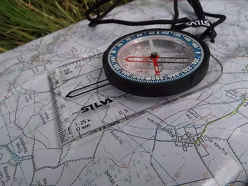
- Are maps good for UX? Maps can be a great tool for UX, but they must be used correctly. An interactive map that helps a user find a location is a great example of a map that enhances UX. A background map that is purely decorative can also enhance UX, but it must be carefully designed so that it does not interfere with the user’s ability to use the website. A good topographic map can be a great UX tool.
Best Use Cases: Choosing the Right Background for Your Project
The choice between a topographic map and a satellite image as a website background depends on the specific goals of the project. Here are some best use cases for each:
- When to Use a Topographic Map Background:
- Outdoor & Adventure Brands: A topographic map is a natural fit for brands that sell outdoor gear, offer adventure tours, or cater to an audience that loves to explore. It reinforces a sense of place and adventure, and it speaks to a shared passion for the outdoors.
- Data & Tech Companies: A topographic map can be a great choice for tech companies that want to project a sophisticated and analytical image. It represents the complex data landscapes that they navigate, and it can be a subtle nod to their technical expertise.
- Architectural & Engineering Firms: A topographic map is a perfect fit for architectural and engineering firms. It aligns with their focus on precision, planning, and structure. It can be a beautiful and elegant way to showcase their work, and it can also be used to provide context for their projects.
- Minimalist Designs: A topographic map is an excellent choice for minimalist designs. It can add a touch of texture and interest to a design, without overwhelming it. It can be a subtle and elegant way to create a sense of place, without resorting to a busy and distracting image. A topographic map is a versatile tool.
- When to Use a Satellite Image Background:
- Real Estate & Development: A satellite image can be a powerful tool for real estate and development companies. It can be used to showcase a property in its actual environment, and it can also be used to provide context for a new development. It can be a beautiful and immersive way to sell a property, and it can also be used to create a sense of excitement and anticipation for a new project.
- Travel & Tourism Agencies: A satellite image is a natural fit for travel and tourism agencies. It can be used to showcase beautiful destinations, and it can also be used to inspire wanderlust. It can be a beautiful and immersive way to sell a travel package, and it can also be used to create a sense of excitement and anticipation for a trip.
- Environmental & Conservation Organizations: A satellite image can be a powerful tool for environmental and conservation organizations. It can be used to illustrate the scale and reality of environmental issues, and it can also be used to showcase the successes of conservation efforts. It can be a beautiful and moving way to raise awareness for a cause, and it can also be used to inspire people to take action.
- Local Businesses: A satellite image can be a great way for local businesses to connect with their community. It can be used to show the business in its actual location, and it can also be used to provide context for the business’s services. It can be a beautiful and immersive way to attract new customers, and it can also be used to create a sense of community.
Hybrid Approaches and Modern Solutions
The choice between a topographic map and a satellite image is not always a binary one. There are many hybrid approaches and modern solutions that can be used to create a unique and engaging user experience.
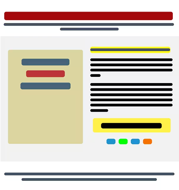
- Layering and Opacity: One popular technique is to layer a semi-transparent color overlay on top of a satellite image. This can be used to reduce the visual noise of the image, and it can also be used to create a more cohesive and on-brand look. The color overlay can be a solid color, a gradient, or even a pattern. This technique can be used to improve readability, and it can also be used to create a more sophisticated and elegant design.
- Interactive Backgrounds: Another modern solution is to use an interactive background. This can be done using a service like Mapbox or the Google Maps Platform. An interactive background allows the user to pan, zoom, and explore the map. This can be a great way to create a more engaging and immersive user experience. It can also be used to provide more context for the website’s content.
- Vector Topography: A vector topographic map is a great choice for performance and scalability. A vector topographic map is made up of mathematical equations, rather than pixels. This means that it can be scaled to any size without losing quality. It also means that it has a very small file size, which is great for page load speed. A vector topographic map is a great choice for websites that need to be fast and responsive.
- Dynamic Imagery: Dynamic imagery is a technique that uses a background that changes based on the time of day or the user’s location. This can be a great way to create a more personalized and engaging user experience. For example, a travel website could use a background that shows a satellite image of the user’s current location. Or, a weather website could use a background that shows a live weather map of the user’s area. Dynamic imagery is a great way to create a more immersive and relevant user experience.
Conclusion: The Verdict on Topographic vs. Satellite Backgrounds
In the end, there is no single “better” option when it comes to choosing between a topographic map and a satellite image as a website background. The choice is dictated by the specific context, brand, and user goals of the project. A topographic map is a great choice when clarity, performance, and a clean, technical aesthetic are paramount. A satellite image is a great choice when the primary goal is emotional impact, realism, and providing specific geographical context.
The most important thing is to make a thoughtful and informed decision. Consider your target audience, your brand identity, and the goals of your website. And don’t be afraid to experiment. A/B testing can be a great way to see which option performs better with your users. The right background can make all the difference in creating a successful and engaging user experience. A topographic map is a great option for many websites.